Term: SC002 star map
The SC001 provides a map of the equatorial region of the celestial
sphere. We also need a map near the north celestial pole.
The Mercator-type projections are increasingly inaccurate as we
move away from the celestial equator, so a different type of projection
is needed. Polar projections map the poles so that a pole is
at the center, and the hour circles (which all meet at the poles)
radiate out as straight lines, and the diurnal circles which
surround the pole, are displayed as circles. For a north polar
projection, declination=90° is at the center, the inner-most
circle has declination=80°, followed by 70°...
The outer-most circle on the SC002
has declination=30°, so there is a lot of overlap between the outer
edge of the SC002 and the top of the SC001. RA is measured around
the circles, with 0h at the top, 6h on the right,
12h on the bottom, and 18h at the
left. You should be able to roll up your SC001 into a cylinder
and place your SC002 on top and have the RAs match up. Remember the
star side should be found on the inside of the cylinder!
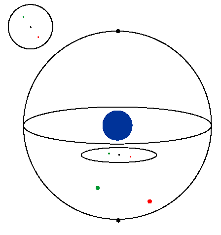
The below diagram shows how we could make a polar projection of the
south celestial pole. It's the same process for the north celestial
pole.

NEXT

