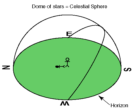
In the below diagram I've placed a stick figure of a person in a green open field, and marked the cardinal directions on the horizon with the appropriate letters (NESW). Unless you live in Kansas, real horizons are partially obstructed, but we can imagine what the view would look like without buildings and trees getting in the way. The horizon would then be a 360° circle where sky meets ground.
My aim in these pages is to describe a particular way of mapping the sky: the sky map. On other pages I've described how the celestial sphere can be mapped in ways analogous to Mercator projections of the globe (the SC001 star map) and analogous to polar projections of the globe (the SC002 star map). These maps give good presentations of the shapes of the constellations, but do not give you much help in locating these constellations in your sky. Star Finders do a pretty good job of approximately displaying the sky, but because they aim to work for a wide range of places and times they necessarily introduce various distortions and approximations. Sky maps are computer created presentations of the sky at your location at a particular time. For example, to use the Your Sky web-based sky mapper from John Walker's Fourmilab you must enter your latitude (45.583° North for CSB/SJU) and longitude (94.390° West for CSB/SJU) and click the Make Sky Map button. Then set the universal time (UT is 6 or 5 [for DST] hours ahead of our local Central time) to the desired time and click the Update button. The sky -- as it will be at that time and place -- will then be displayed. Note that, unlike the other maps, a sky map can show "wandering" objects likes planets. To print out a sky map from this site please select black on white background. (Printing a mostly black sky is hard on printers!)
A selection of sky maps made for CSB/SJU are available here. Larger and smaller versions are also available.