Our SC001 star map is similar to these Mercator projections of the globe. The celestial equator divides the map in half top-to-bottom: north hemisphere at the top and south hemisphere at the bottom) with right ascensions running from 0h at the map's center to 12h at the left edge. The run of RA picks up at the right edge again at 12h, and continues to 23h and finally back to 0h=24h at the center. Note that RA increases to the left, which is eastward. Yes, eastward is to the left, not right as on most maps of the globe. The reason is one of perspective. World maps are made as if God was looking down from space on the outside surface of the globe. Sky maps are made looking out from Earth toward the inside surface of the celestial sphere. Indeed if you think about facing south, and pointing the south-part (bottom) of the SC001 toward the south celestial pole, and the north-part (top) of the SC002 toward the north celestial pole, the left side of the map is toward the east. Declination ranges from -60° at the bottom to +60° at the top.
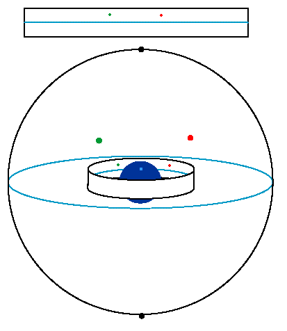
The below drawing shows how we can project the inside surface of the celestial sphere onto the inside surface of a cylinder, which we can then cut into a large rectangle. The red and green stars are on the far side of the celestial sphere, in the northern hemisphere; they end up above the blue celestial equator.